Union Minister for Rural Development Shri Shivraj Singh Chouhan inaugurated the International Workshop on the use of “Modern Technologies in Survey-Resurvey for Urban Land Records” at Dr. Ambedkar International Centre in New Delhi today through video conferencing. Shri Shivraj Singh Chouhan, in his keynote address as the Chief Guest reaffirmed the commitment of Govt. of India in boosting digitization and maintenance of land records under the Digital India Land Records Modernization Programme (DILRMP). Highlighting the importance of the quality land records, Minister stated that digitally updated and transparent land records facilitate optimization of the land resources and sharing of information with various agencies for assisting in policy and planning. He elaborated that for a robust property record and tax administration, seamless access to land records is crucial to enhance the effectiveness and efficiency of public service delivery through various schemes of the Centre and States. Minister emphasized the need for close coordination in the Central and State Governments and requested the Department of Land Resources and State Governments to work in close coordination.

He also discussed the steps taken by the Government of Madhya Pradesh in creating urban land records and informed that drone flying has been completed in 34 towns and Orthorectified Imagery (ORI) production is complete in 12 towns. He expressed his happiness on the pilot programme called the “National geospatial Knowledge-based land Survey of urban Habitations (NAKSHA)” of the Department of Land Resources with a view to create Land Records in Urban Areas. The Pilot project will be started in more than 100 cities/towns in all the States / UTs and it is expected to be completed in one year’s time. This will be followed by full-fledged survey which would cover the entire urban area in the country within a period of 5 years. Shri Chouhan added that he is happy to report that aerial photography with 3D imagery is a powerful tool for urban planning. Considering the rainfall and flood situation at the local level, it is very important to develop better drainage and flood management. Aerial photography with accurate GPS coordinates will help in accelerating the speed of land survey, which will ultimately be useful in property tax assessment, better transport system, planning of drainage and flood management and preparation of master plans for our urban areas.
Shri Shivraj Singh Chouhan said that he is happy to inform that his department is making tireless efforts in this direction. He wanted to consult with experts from other countries on creation and reconciliation of land records and this two-day conference is an effort to discuss and understand global best practices in the use of new and emerging technologies in this regard. He is sure that the distinguished participants will put forth their views which will be discussed in detail during the sessions. He requests the representatives of the State Governments present here to actively participate in the discussions, because only with the cooperation of the States will we be able to integrate modern technologies in urban land administration and improve efficiency and transparency in land management systems. We will benefit from the presence of experts from around the world and the knowledge they present will help us apply modern technologies in land management.
Union minister extended his best wishes for successful organization of this event and he hope that the information gained from the workshop will help the government in formulating policies to further strengthen the urban local bodies.
Secretary, Department of Land Resources, Ministry of Rural Development, Shri Manoj Joshi said that this international workshop has been organized and along with this we have started a pilot program to conduct surveys in urban areas. For this, Survey of India is our technical partner so that drone flying can be done in all the cities. From the images obtained from drone flying, the revenue and urban departments of the states will prepare urban land records, master plans and drainage records of cities. The objective of this workshop is that foreign experts in land records can take advantage of the experts in software. States which have done the land record survey work. They will be able to share information with each other. We will be able to complete this work of land records in one year.
In the inaugural session, Shri Kunal Satyarthi, Joint Secretary, Department of Land Resources, Govt. of India welcomed the participants and set the agenda of the workshop. Shri Abedelrazq Khalil, World Bank’s Practice Manager for Urban and Land, South Asia Infrastructure Department highlighted the importance of land records in Urban area. Shri Vivek Bharadwaj, Secretary, Ministry of Panchayati Raj, Govt. of India shared experience of SVAMITVA Scheme and stressed the urgent need for digital land records for urban area too.
The first session of the Workshop on International Best Practices in Establishing and Maintaining Urban Digital Land Record was chaired by Shri Manoj Joshi, Secretary, Department of Land Resources and moderated by Mr. Klaus Deininger, Lead Economist, World Bank. This session had global participation from the land registration/survey departments of South Korea, Spain, Netherlands, France, United Kingdom, Australia, Japan, USA, Germany. The importance of registration laws, land surveying, aerial mapping and the integration and implementation of GIS was discussed extensively, during this session.
The workshop is a unique gathering of the stakeholders from the Ministries/Departments of the Government of India, Revenue and Urban Development Secretaries of 34 States/UTs, the Municipal Commissioners, international experts, Municipal officers /CEOs of around 120 Urban Local Bodies which are taking part in the Pilot programme National Geospatial Knowledge based Survey of habitations (NAKSHA) for Modernization of Urban Land records and industry &technology partners from India and abroad.
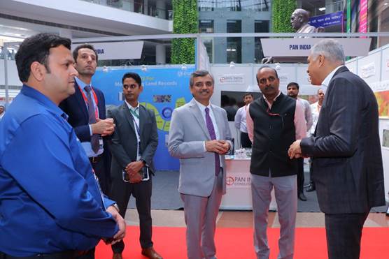
Further, a Technology Exhibition on survey and resurvey featuring more than 30 Technology Companies from India as well as abroad was inaugurated by Shri Manoj Joshi, Secretary, Department of Land Resources, Govt. of India.
Comments are closed.